Tag Archives: National Weather Service

7 ways to report severe weather to NWS without ham radio

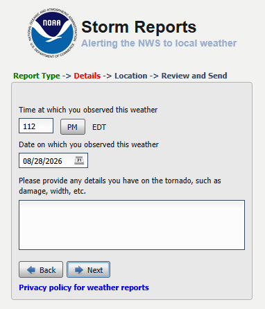
A screen shot of an NWS web form for reporting severe weather.

When the National Weather Service (NWS) started its Skywarn program in the 1960s, the first participants were licensed amateur (ham) radio operators. While many ham radio operators remain active in the program, the Skywarn storm spotters of today have many ways other than ham radio to send their reports. This article covers some of those communication channels for the benefit of spotters who don’t have ham radio licenses and for hams who need to send reports when their local on-air Skywarn networks are not active.

Phone calls

When a Weather Bureau meteorologist started the first ham radio Skywarn network after the Palm Sunday tornadoes of 1965, few people had car phones. Now, approximately 97% of the US population carries or owns a cell phone of some kind, according to data from the Pew Research Center. To report a tornado, funnel cloud, wind damage, etc. directly to an NWS weather forecast office (WFO), a trained storm spotter need only dial that office. Most WFOs have set aside a phone line for the sole purpose of receiving spotter reports.

A phone call gets attention in the WFO faster than most other reporting methods, so dialing the WFO is probably the best choice for the most dangerous sightings, like funnel clouds and tornadoes.

To keep people from using spotter phone numbers for other purposes, WFOs do not usually make them available on the web or other public communications. They usually provide special phone numbers during local storm spotter training classes. If you’ve taken the spotter course and misplaced the number, contact your local WFO now (via a number on the WFO’s website), tell them when you took the Skywarn training, ask for the number, and store it in your phone.

Alternatively, if you are a member of Spotter Network (see below), that organization’s “Submit Report” web page usually provides the spotter phone number for the appropriate WFO, based on your location.

NWS web forms

Any spotter who has access to the web (including via a mobile phone) may enter a report on a web form for any WFO. The URL is the same, no matter where you are: https://inws.ncep.noaa.gov/report/.

Spotter Network

Spotter Network, Inc. is a non-profit organization that is dedicated to bringing storm spotters, storm chasers, coordinators and public servants together in a seamless network of information. Storm spotters who join the organization and complete its online training may submit their reports via a form on the Spotter Network website. When the website determines the spotter’s location, it displays the location and phone number of the appropriate NWS office. That gives the member the option of calling the WFO for more urgent reports or completing the form. Spotter Network forwards data from its web form directly to the NWS.

X.com (Twitter)

Most WFOs have accounts on the social network formerly known as Twitter. Tagging your local WFO in a tweet is a great way to send a photo to supplement your report. It’s important to remember, however, that a tweet might not get noticed immediately, so a phone call is better for something like a funnel cloud or tornado. To find the correct X.com username to tag, search X.com for “NWS (office name).” For example, a search for “NWS Northern Indiana” reveals that the tag you should include in a tweet for that office is “@NWSIWX.” Don’t assume, however, that all WFOs use their three-letter IDs in their X account names. The Indianapolis office, for example, uses “@NWSIndianapolis,” not “@NWSIND.”

Facebook

Facebook is another way to send photos of severe weather or its impacts. Some NWS meteorologists have told me, however, that during severe weather, their offices don’t always have time to check Facebook often, making it a poor way to report a tornado. Facebook is well-suited, however, for sending photos of storm damage after a storm passes. Such photos can help WFOs decide where to send survey teams the next day. Search Facebook for the page that your local WFO operates. When you get there, post your report as a comment under an existing post on the page.

mPING

Meteorological Phenomena Identification Near the Ground (mPING) is a project to collect weather information from the public through their smart phones or other mobile devices. The free mPING iOS and Android mobile apps were developed through a partnership between the National Severe Storms Laboratory, The University of Oklahoma and the Cooperative Institute for Mesoscale Meteorological Studies. Anyone may download the apps from the Apple App Store or Google Play. Among the weather phenomena that mPING users may report are tornadoes, hail, storm damage and winter weather impacts. The reports use the mobile device’s GPS unit to include the exact location in the report and to route the report to the appropriate WFO. Some other apps, like RadarScope incorporate mPING so users can send reports without changing apps.

Email

Every WFO has a general email address. Meteorologists eventually see messages sent to those addresses. It’s unlikely, however, that such an email message will receive immediate attention, especially during severe weather. This makes email better for after-the-fact damage reports than for tornado reports. To find a WFO’s general email address, scroll to the bottom of the WFO’s web page (e.g. www.weather.gov/ind) and click on the link that reads, “Comments? Questions? Please Contact Us.”
Indiana weather alerts via social media

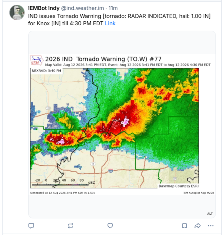
A screen shot of a tornado warning for Knox County, Indiana as it appeared on Bluesky after IEMbot automatically posted it.

I have for many years recommended having multiple sources of severe weather alerts and I have previously blogged about the best sources. Although social media is not the best way to receive information about impending severe weather, it’s one of many tools that can improve your awareness.

When I’m available, I share information such as mesoscale discussions, watches, etc. on various social media channels. I’m rarely available, however, to share National Weather Service (NWS) warnings in a timely manner. Fortunately, such warnings get posted automatcially to certain social media platforms by bots created and operated by Iowa State University’s Iowa Environmental Mesonet.

To find them, you must know which NWS weather forecast office (WFO) provides warnings for your county and you need to know the social media accounts in which that WFO’s alerts get automatically posted.

Start by finding your county on the list below to learn which WFO serves that county. Beneath that list are lists of accounts to follow on each of severel differnet social media platforms.

Indiana CountyWFO
AdamsNorthern Indiana (IWX)
AllenNorthern Indiana (IWX)
BartholomewIndianapolis (IND)
BentonChicago (LOT)
BlackfordNorthern Indiana (IWX)
BooneIndianapolis (IND)
BrownIndianapolis (IND)
CarrollIndianapolis (IND)
CassNorthern Indiana (IWX)
ClarkLouisville (LMK)
ClayIndianapolis (IND)
ClintonIndianapolis (IND)
CrawfordLouisville (LMK)
DaviessIndianapolis (IND)
DearbornWilmington, OH (ILN)
DecaturIndianapolis (IND)
DeKalbNorthern Indiana (IWX)
DelawareIndianapolis (IND)
DuboisLouisville (LMK)
ElkhartNorthern Indiana (IWX)
FayetteWilmington, OH (ILN)
FloydLouisville (LMK)
FountainIndianapolis (IND)
FranklinWilmington, OH (ILN)
FultonNorthern Indiana (IWX)
GibsonPaducah, KY (PAH)
GrantNorthern Indiana (IWX)
GreeneIndianapolis (IND)
HamiltonIndianapolis (IND)
HancockIndianapolis (IND)
HarrisonLouisville (LMK)
HendricksIndianapolis (IND)
HenryIndianapolis (IND)
HowardIndianapolis (IND)
HuntingtonNorthern Indiana (IWX)
JacksonIndianapolis (IND)
JasperChicago (LOT)
JayNorthern Indiana (IWX)
JeffersonLouisville (LMK)
JenningsIndianapolis (IND)
JohnsonIndianapolis (IND)
KnoxIndianapolis (IND)
KosciuskoNorthern Indiana (IWX)
LaGrangeNorthern Indiana (IWX)
LakeChicago (LOT)
LaPorteNorthern Indiana (IWX)
LawrenceIndianapolis (IND)
MadisonIndianapolis (IND)
MarionIndianapolis (IND)
MarshallNorthern Indiana (IWX)
MartinIndianapolis (IND)
MiamiNorthern Indiana (IWX)
MonroeIndianapolis (IND)
MontgomeryIndianapolis (IND)
MorganIndianapolis (IND)
NewtonChicago (LOT)
NobleNorthern Indiana (IWX)
OhioWilmington, OH (ILN)
OrangeLouisville (LMK)
OwenIndianapolis (IND)
ParkeIndianapolis (IND)
PerryLouisville (LMK)
PikePaducah, KY (PAH)
PorterChicago (LOT)
PoseyPaducah, KY (PAH)
PulaskiNorthern Indiana (IWX)
PutnamIndianapolis (IND)
RandolphIndianapolis (IND)
RipleyWilmington, OH (ILN)
RushIndianapolis (IND)
St. JosephNorthern Indiana (IWX)
ScottLouisville (LMK)
ShelbyIndianapolis (IND)
SpencerPaducah, KY (PAH)
StarkeNorthern Indiana (IWX)
SteubenNorthern Indiana (IWX)
SullivanIndianapolis (IND)
SwitzerlandWilmington, OH (ILN)
TippecanoeIndianapolis (IND)
TiptonIndianapolis (IND)
UnionWilmington, OH (ILN)
VanderburghPaducah, KY (PAH)
VermillionIndianapolis (IND)
VigoIndianapolis (IND)
WabashNorthern Indiana (IWX)
WarrenIndianapolis (IND)
WarrickPaducah, KY (PAH)
WashingtonLouisville (LMK)
WayneWilmington, OH (ILN)
WellsNorthern Indiana (IWX)
WhiteNorthern Indiana (IWX)
WhitleyNorthern Indiana (IWX)

Bluesky

If you use the social media platform Bluesky, follow the IEMbot account below that’s associated with your WFO from the list above:

WFOBluesky IEMbot account
Chicago@lot.weather.im
Indianapolis@ind.weather.im
Louisville@lmk.weather.im
Northern Indiana@iwx.weather.im
Paducah@pah.weather.im
Wilmington, Ohio@iln.weather.im

X.com (formerly Twitter)

On X.com, you can follow two different accounts for each WFO. Posts in each WFO’s official account are created manually by NWS meteorologists as they have time. Posts in the IEMbot account are created automatically from the alerts that the WFO creates.

WFOX.com official accountX.com IEMbot account
Chicago@NWSChicago@iembot_lot
Indianapolis@NWSIndianapolis@iembot_ind
Louisville@NWSLouisville@iembot_lmk
Northern Indiana@NWSIWX@iembot_iwx
Paducah@NWSPaducah@iembot_pah
Wilmington, Ohio@NWSILN@iembot_iln

Mastodon

Iowa Environmental Mesonet does not appear to have created IEMbot accounts on Mastodon, but my Mastodon account automatically posts IEMbot data for every Indiana county. You may follow it at @jayfarlow@wx.social.

Facebook

I”m not aware of any Facebook account that automatically posts all the warnings of WFOs that serve Indiana. In addition, Facebook’s algorithm can create significant delays. Each WFO has it’s own Facebook account (below) to which meteorologists manually post valuable information, so these are nonetheless worth following.

WFOFacebook page
Chicagohttps://www.facebook.com/NWSChicago
Indianapolishttps://www.facebook.com/NWSIndianapolis
Louisvillehttps://www.facebook.com/NWSLouisville/
Northern Indianahttps://www.facebook.com/NWSNorthernIndiana/
Paducahhttps://www.facebook.com/NWSPaducah/
Wilmington, Ohiohttps://www.facebook.com/NWSWilmingtonOH/

Web

Every WFO also has its own web page that’s worth bookmarking and visiting on a regular basis.

Tornado strikes NW Allen County July 29

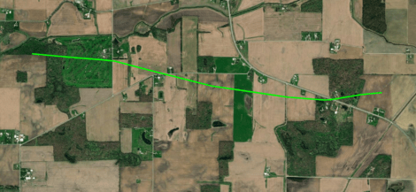
Path of a tornado that touched down just west of the Eel River Golf Course south of Churubusco and tracked rapidly east southeast, crossing US 33 before dissipating in a corn field west of Chase Road. NWS image.

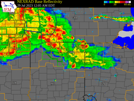
The National Weather Service Northern Indiana weather forecast office (IWX) announced August 2 that it found evidence that a tornado did damage in eastern Whitley County and northwestern Allen County, Indiana at approximately 2:30 a.m. July 29.

“But wait,” you might say, “I never heard about a tornado warning for Allen County that day!” That’s because IWX didn’t issue a tornado warning for this storm. At the time of the tornado, however, a severe thunderstorm warning was in effect that included the words, “tornado possible.”

Most severe thunderstorm warnings do not automatically create alerts on your cell phone.

It’s not unusual for the kind of storm we had Saturday morning (a bowing “squall line”) to spawn weak tornados that appear and disappear before the National Weather Service can issue a warning. That’s why, when they warn us of a severe thunderstorm that could contain such tornados, they mention that a tornado is possible.

Weather radar loop slowing the bowing squall line that moved across Indiana early July 29.

It’s also one reason that it’s so important to know about and react appropriately to severe thunderstorm warnings, including those the National Weather Service issues in the middle of the night, when you’re sleeping. But that requires extra effort on your part, because most severe thunderstorm warnings do not automatically create alerts on your cell phone.

If you’ve ever been someplace covered by a tornado warning, you probably received a Wireless Emergency Alert (WEA) on your phone, even if you never installed a weather app. That’s because all modern smartphones come with WEAs enabled and all tornado warnings prompt WEAs.

The only severe thunderstorm warnings that trigger WEAs, however, are those in which the National Weather Service includes a “destructive” damage threat “tag.” They do that for storms that have either hail that’s at least 2.75 inches in diameter (baseball-sized) and/or 80 mph straight-line thunderstorm winds. According to Saturday morning’s severe thunderstorm warning, meteorologists expected winds of up to 60 mph and no large hail. That warning therefore did not trigger a WEA.

So, how can you know if a storm like Saturday’s is headed toward your home in the middle of the night, while you’re asleep? I know of two really good ways:

  1. Buy a weather alert radio and keep it near enough to your bedroom to wake you.
  2. Install a weather alert app, like Storm Shield, and configure it to alert you to severe thunderstorm warnings.

When the NWS issues a severe thunderstorm warning for your location, the best way to be safe is to do the same thing you’d do in a tornado warning. Move to the most interior room on the lowest level of your house. This will provide the best protection from a brief tornado, like the one that touched down July 29 and from straight-line thunderstorm winds dropping a tree limb on your house, which is what killed a woman in Ohio City, Ohio July 20.

Why do some storm chasers call 911 vs NWS?

After a small tornado outbreak in Indiana and neighboring states yesterday, I’ve been looking at some tornado videos published by storm chasers. On at least two of them, one can hear on the audio track references to calling 911 to report the tornado. On one, you can hear a chaser instructing a public safety answering point (PSAP) operator to activate warning sirens.
Here’s my question: Why would storm chasers — who one would expect to be familiar with the National Weather Service (NWS) warning system — call 911 instead of the NWS?

Why would storm chasers — who one would expect to be familiar with the National Weather Service (NWS) warning system — call 911 instead of the NWS?

Sure, a call to the local PSAP might lead to activation of outdoor warning sirens, which might alert some nearby residents — especially ones who are outdoors — that something is going on. But it won’t lead to activation of NOAA weather radios, wireless emergency alerts on cellular phones, or alerts on broadcast channels until and unless the NWS knows about the tornado and issues an official tornado warning.

You might think that a call to 911 will get a report to the NWS. In reality, that’s not necessarily true. I’ve attended several meetings of an NWS integrated warning team, where PSAP representatives have repeatedly said that during periods of severe weather, they’re so busy answering phones, that they don’t have time to  call NWS. And an NWS warning coordination meteorologist has personally told me that his office yearns to know what citizens are reporting to 911, but can’t get the information.

Granted, calling 911 is easy, especially for chasers whose anxiety levels have reached a near panic stage as they stare down tornadoes. After all, calling 911 when something bad happens is almost a reflex. But a single call to the NWS would get life-saving information to a whole lot more people who are in the path of the storm.

There is a challenge, though, especially for chasers who are always moving from county to county (and for some, state to state) as they try to get in position to see tornadoes. They must always know exactly where they are and they must know which NWS office to call. Adjacent counties are not always served by the same NWS office.

The first part (knowing exactly where you are) is challenging enough, when you’re driving through unfamiliar territory. I’ve heard numerous spotters and chasers, who, while trying to make a report to NWS offices, were unable to say exactly where they were, much less where the funnel cloud or tornado was. Knowing what county your are in and knowing what NWS office serves that county is even more difficult. In truth, any NWS office will accept a tornado report from outside its area and get that information immediately to the correct office. So calling the “wrong” NWS office is probably still better than calling 911, when it comes to warning the most people.

But there’s an even better solution. Members of Spotter Network, Inc. can use a combination of location-reporting software on their smartphones and the Spotter Network website to learn immediately the phone number of the NWS office that covers whatever location they’re in at the moment.

University demonstrates questionable understanding of tornado warnings https://farlowconsulting.com/2017/11/05/university-demonstrates-questionable-understanding-of-tornado-warnings/
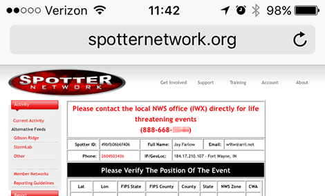
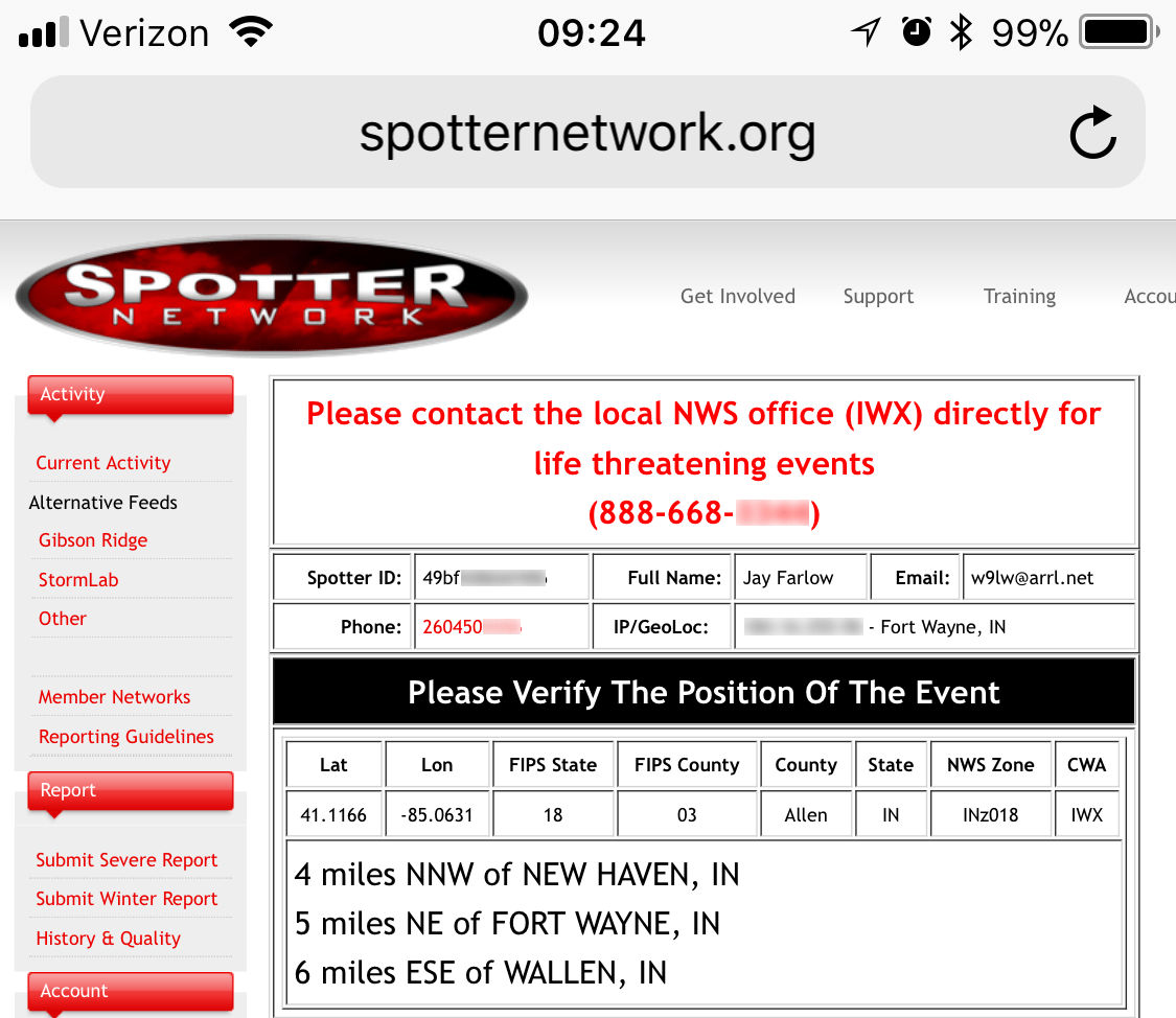
The Spotter Network website can tell members where they are, which NWS office to call, and the phone number for that office.

By using the location-beaconing software, staying logged into the Spotter Network website and bookmarking the “Submit Severe Report” page above, chasers and spotters can learn the best NWS number to call with a couple touches of their smartphones. The result will be warning a lot more people a lot sooner than calling 911 can.

An unexpected honor

2017 Weather-Ready Nation Ambassador of Excellence graphic

I was surprised and honored that this blog was chosen by the northern Indiana office of the National Weather  as a 2017 Weather-Ready Nation Ambassador of Excellence.

If your organization is interested in helping the National Weather Service spread important weather safety messages, check out the WRN Ambassador program.

Some highlights from Central Indiana Severe Weather Symposium 2016

A conference room full of storm spotters, emergency managers, meteorology students and other weather enthusiasts attended the 2016 Central Indiana Severe Weather Symposium March 7 on the campus of Butler University in Indianapolis. Photo by Daniel McCarthy, NWS Indianapolis.
A conference room full of storm spotters, emergency managers, meteorology students and other weather enthusiasts attended the 2016 Central Indiana Severe Weather Symposium March 7 on the campus of Butler University in Indianapolis. Photo from Twitter by Daniel McCarthy, NWS Indianapolis (@Torn8oDan).

The 2016 Central Indiana Severe Weather Symposium, hosted by the Indianapolis office of the National Weather Service (NWS) and the Indiana chapter of the American Meteorological Society, provided a full day of interesting presentations. Below are a few highlights.

Squall lines made cooler

Kwiatkowski presents on quasi-linear convective systems. Photo from Twitter by John Dissauer (@johndissauer).
NWS meteorologist John Kwiatkowski presents on quasi-linear convective systems. Photo from Twitter by John Dissauer (@johndissauer).

John Kwiatkowski of the NWS Indianapolis office provided a presentation on Quasi-Linear Convective Systems (QLCS). Early in his talk, Kwiatkowski explained that this is the same type of storm that meteorologist formally called a “squall line.” Kwiatkowski joked that the new name sounds much cooler and that using it will impress members of the opposite sex.

QLCSs are much more common in Indiana than are supercell thunderstorms. Yet, as Kwiatkowski explained, spotting a QLCS in the field can be more dangerous than watching a discrete supercell out in the plains. Part of a QLCS can produce very damaging straight-line winds without appearing any different to a field observer than any other part of the storm. It can also produce essentially invisible, rain-wrapped tornadoes which, while small and brief, can easily overturn a spotter’s car. Kwiatkowski advised staying home and reporting damage after the storm passes.

It’ll never happen to me (and if it does, I can handle it)

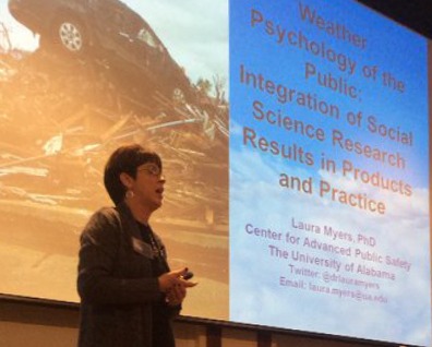
Dr. Laura Myers presents on weather psychology at the 2016 Central Indiana Severe Weather Symposium. Photo by NWS Indianapolis
Dr. Laura Myers presents on weather psychology. Photo by NWS Indianapolis

Dr. Laura Myers, a research scientist at the University of Alabama’s Center for Advanced Public Safety, provided a presentation titled “Weather Psychology of the Public: Integration of Social Science Research Results in Products and Practice.” She pointed out a variety of issues regarding how (and whether) people respond to weather warnings.

Myers said that a significant challenge of the weather enterprise is to make people understand that the benefits of safe behavior outweigh the costs and inconvenience.

Among the many discoveries she presented were some that will likely surprise weather enthusiasts:

  • Most people either don’t believe severe weather will ever affect them (it will always happen to someone else), or they believe that they are uniquely able to handle it.
  • Not everyone has a single, good warning modality, but people should have more than two.
  • Upon first learning of a weather alert, people often waste time seeking secondary confirmation, sometimes leaving insufficient time to take adequate shelter.
  • Most people don’t know what county they are in, even if they live there.
  • The tone, seriousness and message of broadcast meteorologists can make a difference in how people respond to threats.
  • Words like “emergency” in weather communications prompt more action but must be used sparingly.
  • During the 2012 derecho, severe thunderstorm warnings did not lead people to understand how dangerous the storm was. Many told surveyors that they would have behaved differently, had they known what the storm would do.

Storm spotters, chasers and other weather enthusiasts are in a unique position to help change how people respond to severe weather threats. As I’ve written before (see “Storm spotters as advocates“),  we are often the trusted weather experts in our families and social circles. We can take advantage of that position to help those people understand how to stay safe.

Mobile home! Duck!

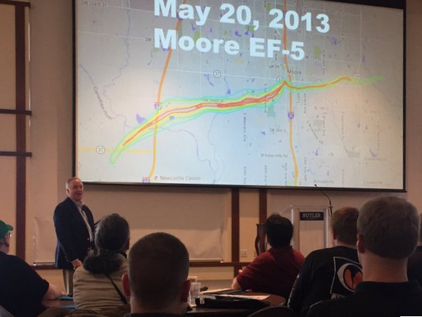
At the 2016 Central Indiana Severe Weather Summit, well-known storm chaser Jeff Piotrowski discusses how he chased the 2013 El Reno, Oklahoma tornado. Photo from Twitter by Kalie Pluchel (@KaliePluchelWX).
Well-known storm chaser Jeff Piotrowski discusses how he chased the 2013 El Reno, Oklahoma tornado. Photo from Twitter by Kalie Pluchel (@KaliePluchelWX).

Well-known storm chaser Jeff Piotrowski discussed how he chased the 2013 El Reno tornado, the widest tornado in recorded history. His presentation included a great deal of compelling video of the storm.

At one point during the chase, a mobile home flew over Piotrowski’s car close enough to knock off a roof-mounted camera and antenna. Piotrowski saw it coming just in time to tell his wife to duck.

Piotrowski told the crowd that second-by-second situational awareness — including looking at the sky, not just a radar — is the only reason he survived the tornado. He said that during a chase, he never shuts off his car’s engine. And he reminded the audience that debris can travel four miles from tornado.

A peek behind the curtain

NWS meteorologist Amanda Lee begins a presentation on what goes on at the Indianapolis NWS office during severe weather events. Photo from Twitter by John Lobban Radio (@JohnLobbanRADIO)

NWS Meteorologists Amanda Lee and Marc Dahmer provided a behind-the-scenes look at how the their Indianapolis office works during severe weather, complete with entertaining video shot in the forecast office.

They showed how the NWS WarnGen software creates warnings based on choices the warning meteorologist makes.

They also showed how the general public can access data from post-event damage assessments, sometimes within minutes of data entry in the field. The public-view version of the NWS Damage Assessment Toolkit is at https://apps.dat.noaa.gov/StormDamage/DamageViewer/. It requires Adobe Flash, which makes it inaccessible on iOS devices.

Building a Weather-Ready Nation

NWS Indianapolis warning coordination meteorologist Dave Tucek discusses the NWS Weather-Ready Nation program. Photo from Twitter by Mike Alley (@malley57)

Dave Tucek, warning coordination meteorologist for the Indianapolis NWS office, provided an introduction the the agency’s “Weather-Ready Nation” (WRN) initiative. His talk included information on severe weather climatology and the value of organizations becoming WRN Ambassadors. Although the Ambassador designation is not available to individuals, Tucek pointed out that “We all have a part in spreading the weather-ready message.”

No green screen

Chris Wright of WTTV TV-4, Indianapolis, speaks about his career as a weather broadcaster. Photo from Twitter by John Dissauer (@johndissauer).

Chris Wright of WTTV TV-4, Indianapolis, spoke about his career as a weather broadcaster. Interesting tidbits from his presentation included:

  • His station uses no green screen. Instead of chroma key, his weather graphics appear on a bank of nine video monitors.
  • During severe weather break-ins, it’s not unusual for a superior to tell him to keep talking. Wright told the crowd that if they see a weather break-in that lasts for more than 30 seconds, it wasn’t the weather person’s decision.
  • News anchors often don’t watch the weather segment of a newscast. That’s why the weather person recaps the forecast as part of his hand off back to the anchors.
  • Social media has significantly increased the workload in TV weather departments. Wright said that keeping up with Twitter, Facebook, blogs, etc. sometimes requires having two people per shift.

At colleges, students aren’t always the biggest emergency management challenge

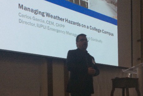
IUPUI emergency manager Carlos Garcis talks about hazard management on a college campus. NWS photo.
IUPUI emergency manager Carlos Garcis talks about weather hazard management on a college campus. NWS photo.

Carlos Garcia, emergency manager for the Indiana University – Purdue University Indianapolis campus, talked about how the campus prepares for severe weather.

He said federal law requires universities to warn their communities of threats in a timely manner. He pointed out that college students are adults, who need to accept responsibility for their decisions in emergency situations. But he also indicated that students aren’t necessarily the biggest challenge with regard to appropriate response to notifications. That’s one reason the campus invested in software for all campus computers that can automatically display alerts. The software will even interrupt a professor’s PowerPoint presentation, displaying a notification to everyone in the classroom of the situation.

Photo gallery

A gallery of photos of the event from Gregory Chaney is available on Flickr.

Making storm spotter reports while traveling

U.S. map showing county warning areas of each National Weather Service weather forecast office
County warning areas of each National Weather Service weather forecast office (NWS image).

During the Central Indiana Severe Weather Symposium, March 5, 2016 in Indianapolis, an attendee asked how spotters, particularly those who are hams, can report to appropriate National Weather Service (NWS) weather forecast offices (WFO) while traveling away from home.

There are several good answers to that question. It helps to know that each WFO has its own area of responsibility, which the NWS calls a county warning area (CWA). It is defined by a list of counties (or parishes) for which that WFO issues weather warnings. Generally speaking, every county in a given WFO’s CWA is closer to that WFO’s doppler radar station that to any other WFO’s radar. This is why CWAs often cross state lines.

If you want to make a spotter report while traveling, therefore, you need to know two things:

  1. Which WFO’s CWA you’re in.
  2. How to contact that WFO.

SpotterNetwork.org

SpotterNetwork.org's reporting page displays the ID and phone number of the appropriate NWS office to members who are logged in and using a location-reporting app.
SpotterNetwork.org’s reporting page displays the ID and phone number of the appropriate NWS office to members who are logged in and using a location-reporting app.

By far, the simplest way to accomplish both steps above is to register with SpotterNetwork.org and install compatible position-reporting software on a smartphone or similar GPS- and mobile- data-equipped mobile device.

I use WDT’s RadarScope app on my iPhone. According the the SpotterNetwork.org website, Android users have several additional choices, including ChaserLocation, PYKL3 Radar and Radar Alive!

In my case, RadarScope (when properly configured and activated) continually transmits my iPhone’s GPS coordinates to SpotterNetwork.org servers. If I need to make a report, I just log into my account on SpotterNetwork.org’s home page with any Web browser (including the one on my phone), and then select the “Submit Severe Report” link.

Because SpotterNetwork.org knows where I am, it displays at the top of the reporting page the three-letter identifier of the WFO whose CWA I’m in and the best telephone number through which to make a report to that WFO (in most cases, it’s the “bat phone” number that’s reserved for spotters). Then, I can call that number (the best choice for life-threatening situations, like a tornado) or enter my report into the SpotterNetwork.org website and let SpotterNetwork.org send it to the proper WFO electronically.

Weather.gov

The watch-warning-advisory map on the NWS home page allows viewers to find the NWS office for any location by clicking that location on the map.

You can determine the appropriate WFO for any location in the country by using the NWS home page, www.weather.gov. Just click anywhere on the U.S. map. Near the top of the Web page that appears, you’ll see a headline that indicates the name of the WFO in whose CWA you clicked. If you scroll to the bottom of that page, you’ll find a phone number for that WFO. Unfortunately, it’s the main office phone number, not the special spotter report number. Depending on the time of day and how the WFO set up its phone system, you might not be able to reach a WFO staff member on that number.

Once you get on the appropriate WFO’s website, however, you should be able to easily find a weather reporting Web form, the WFO’s Twitter handle or even a link to the WFO’s Facebook page, all of which provide alternatives to calling.

If you don’t have mobile Internet, you can use weather.gov before your trip to make your own list of the WFOs through whose CWAs your route will take you.

911

You can call 911 to report life-threatening weather. The phone system will automatically route your call to an appropriate public safety answering point (PSAP) for your location, where a staff member will know how to relay your report to the appropriate WFO.

Disadvantages of this method include:

  • During times of severe weather, PSAPs are often too busy taking incoming calls to relay any information to the NWS.
  • The PSAP call taker might not appreciate being told about one-inch-diameter hail, even though the WFO would want to know about it.

Amateur (ham) radio

Learning how to make spotter reports via ham radio while out of your normal area can be challenging. You’ll have to determine which frequency is used by hams in your current location. Even if you’re successful, you might not be able to reach the WFO or someone who can relay your report to the WFO.

In most communities, hams conduct weather-related communications on a repeater system.  Ways to learn what repeaters exist in any location include the American Radio Relay League’s (ARRL) printed “Repeater Directory,” the website and apps of the ARRL-endorsed www.rfinder.net and the independent RepeaterBook.com website.

Some listings in the ARRL directory and on repeaterbook.com indicate that a listed repeater is used for weather-related activities. When that indication is available, such repeaters are good places for ham-radio-equipped spotters to start. You might, however, need to try multiple repeaters within range to find one on which a SKYWARN net operates. It’s therefore a good idea to communicate with local hams as you enter an area, so that you’ll already know about local on-air SKYWARN practices before you need to call in a report. This is especially important, because the local SKYWARN net might not permit participation by outsiders.

Call your home WFO

As a last resort, you can always use the “bat phone” number for your home WFO. Be sure to tell the call taker early in the call that you’re outside their CWA and that you’re requesting them to relay your report to the appropriate WFO.

What’s the #1 source for national weather?

Amateur-run Facebook pages should not mislead readers into believing that their information is better than that of the National Weather ServiceShould a Facebook page run by amateur storm chasers promote itself as the best source for weather information? I can’t help but wonder how many (if any) naïve Facebook users foolishly rely on such pages for time-critical safety information, in lieu of the National Weather Service (NWS).

Recently, a Facebook page distributed the graphic above. I’ve blurred out identifying information, because who it was doesn’t matter to the point of this article. But the headline, “The #1 Source for National Weather” certainly caught my eye.

I’ve tried multiple times to contact the owners of the Facebook page that published that graphic. I sent a Facebook message and sent an email message to the email address on their website. I’ve received no response. So, all I know about them is what I see online.

From what I see, both the Facebook page and associated website are published by a group of amateur storm chasers, none of whom appear to have a meteorology degree.

In the U.S., only one source of weather information has the authority to issue the official watches and warnings that trigger weather radios, etc.

Don’t read what I’m not writing! There’s nothing wrong with an amateur-run Facebook page or website distributing interesting or important weather information. I do it all the time on Facebook, this blog, Twitter, etc. What I don’t do, however, is claim that my information is any better than others’.

Why? Because I don’t want anyone to assume that my blog, Facebook page or Twitter feed (or anyone’s for that matter) is a safe and reliable way to get timely, live-saving weather alerts, especially NWS warnings. Not even the NWS’ own Facebook and Twitter feeds are timely enough for that (yet).

That’s also why I consistently encourage readers – for their safety – to maintain timely access to NWS products (e.g. via NOAA Weather Radio, smartphone apps triggered by NWS products, Wireless Emergency Alerts, etc.).

All of us who publish weather information on social media and other Internet channels have a responsibility to inform and remind readers that in the U.S., only one source of weather information has the authority to issue the official watches and warnings that trigger weather radios, etc.: The National Weather Service. Likewise, we must not publish anything that could potentially mislead readers into believing that our social media feeds can keep them as safe as do directly received NWS warnings.

Our readers’ lives could depend on it!

What do you think? Use this blog’s comment function to let us know.

Are Ham Radio SKYWARN Spotters Becoming Irrelevant?


Are ham radio SKYWARN spotters becoming irrelevant, the way that ubiquitous cell phones reduced the importance of repeater autopatches? Comments at a recent meeting hosted by the Northern Indiana National Weather Service could lead one to believe that answer is, “Perhaps.”
The Northern Indiana NWS weather forecast office conducted a workshop October 17 for its Integrated Warning Team (IWT). By NWS definition, an IWT includes the local NWS office, news media and emergency management community. The purpose of the workshop was to find ways to increase data sharing between the three components of the IWT. Representatives of each of the three IWT segments gave presentations on their needs. The comments of the NWS representatives were particularly interesting.
“The only way we really know what’s going on is when we get that ground truth report,” said an NWS presenter. Unfortunately, the NWS is not receiving enough timely reports from its trained spotters. An NWS representative expressed frustration at seeing significant radar data in an area where he knew trained spotters lived but getting no reports.
When reports don’t arrive via traditional means (like ham radio, or messages from emergency officials), the NWS has no choice but to search elsewhere for information. It has started searching on social media networks like Facebook and especially Twitter. It turns out that users of social media often write about the weather they see, because they believe their friends and followers are interested. Members of the IWT acknowledged that most such reports come from people without any weather training. But many social media users send their updates from camera-equipped smart phones and include photos with their reports.
“One picture of a funnel cloud is better than 10 reports from trained spotters,” an NWS representative said.
Does that mean ham radio operators should abandon SKYWARN nets? Perhaps not. But it might be wise to take steps to improve the value of our service. Here are some ideas to consider:

  • Education. By learning all we can about meteorology, we can assure that all our reports are valid and valuable.
  • Technology. By becoming familiar with and using other technologies to supplement ham radio (e.g. tweeting photos from smart phones), we can provide a more complete service while demonstrating our ability to stay on the “cutting edge.”
  • Procedures. By insisting on sounding as professional as possible when we communicate, we can build credibility among any IWT members who monitor or receive our reports.

In upcoming articles, I’ll share more ideas along these lines, especially ways to gain more education and use technology.

“Warning Desensitization” Makes SKYWARN Spotters even more Important

As I wrote earlier, I attended a severe weather symposium March 2, the same day that southern Indiana got slammed by tornadoes. In this post, I’ll share a little more about that conference.
It was the 16th Annual Sever Weather Symposium, organized and hosted by The Ohio State University’s Meteorology Club. This was not storm spotter training or even advanced spotter training. But any spotter who is interested in learning more about severe weather would do well to attend future instances of this symposium.
I was particularly interested in a presentation by Gary Garnet, warning coordination meteorologist, National Weather Service Cleveland, Ohio weather forecast office. Garnet spoke on “Findings from the Joplin Tornado Assessment.” His presentation about the devastating tornado strike in Joplin, Missouri on May 22, 2011 did not focus on meteorology. Rather, he reported on a study he helped to conduct to assess “issues ranging from internal NWS warning operations to dissemination strategies to public warning response.” Garnet and other team members had conducted nearly 100 interviews in Joplin with tornado survivors, business people, media representatives as well as emergency management, NWS and local government officials. The team’s full report is available on the Web.

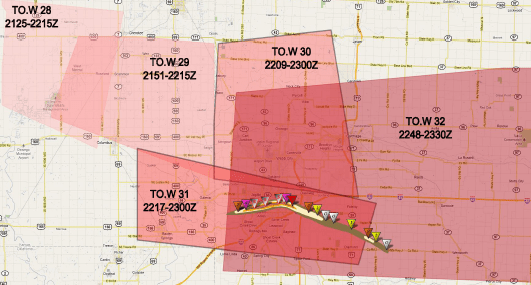
Tornado warnings issued before and during the Joplin tornado. Notice how some of the warning polygons overlap. Graphic courtesy NWS.
Garnet reported that due to warning desensitization, most Joplin residents did not take immediate action when they learned of the NWS tornado warning. Instead, most sought additional information, including going outside to look for the storm, eating away at the 21 minutes between the warning and the beginning of EF-4 tornado damage.

Garnet said “non-routine triggers” are what eventually prompted citizens to take action to protect themselves. For example, Joplin officials broke from their normal practice and sounded tornado sirens more than once. Broadcasters began imploring listeners to “take cover now,” something listeners were not accustomed to hearing.
In some ways, the weather service’s relatively new practice of basing warning areas on storm movement, rather than county lines, adds to the problem. Making warning areas more specific is a good idea but NOAA weather radio still alerts entire counties and many (if not most) tornado siren systems lack the ability to selectively activate sirens. In addition, subsequent warning polygons often overlap each other, confusing citizens.
So, what does all this have to do with ham radio? To me, it reinforces the importance of live reports from trained spotters. The earlier a spotter makes a report, the earlier NWS can issue a warning and the more time citizens have to decide whether they are at risk. Also, when a ham sees a tornado and reports it via radio, a lot of people hear it: other hams, NWS meteorologists, broadcasters and members of the general public who listen to spotter nets on their scanners. Such reports can provide the non-routine triggers that get people to take cover.