University demonstrates questionable understanding of tornado warnings

It’s really important that anyone who is in charge of the safety of an institution — a university campus, for example — maintain an updated, working knowledge of how weather warnings work. Tweets sent today by Indiana University today could lead one to believe that its campus safety staff could benefit from some education in that area.

At 1:19 p.m. EST, the Indianapolis office of the National Weather Service (NWS) issued a tornado warning that included a portion of southern Monroe County, Indiana.  The warning came with a polygon that clearly showed that the IU campus was not included.

Polygon associated with Nov. 5 tornado warning near Bloomington, IN. The National Weather Service issued the warning only for the area inside the red polygon.

In addition, the text of the warning indicated that “a severe thunderstorm capable of producing a tornado was located 12 miles northwest of Bedford, moving east at 30 mph.” In other words, the storm was not moving toward Bloomington or the IU campus (which is why NWS meteorologists drew the polygon as they did).

Six minutes after the NWS issued the warning, IU sent a tweet at 1:25 regarding what it called a “tornado warning for Bloomington.”

Cody Kirkpatrick, an IU lecturer in atmospheric science, attempted to clarify IU’s tweet:

The IU Twitter account replied:

Dr. Kirkpatrick knew what he was talking about. Those sending tweets on behalf of IU demonstrated ignorance of the National Weather Service’s “storm-based warning” system. When the NWS implemented that system a decade ago, it replaced the county-wide warnings to which IU’s tweet refers, with warnings based on polygons that indicate where the actual risk is.

In subsequent tweets, Dr. Kirkpatrick attempted to point that out, as well as the fact that IU’s original tweet was ambiguous. IU’s response:

But is warning people who are not at risk really better than warning only people who are truly at risk? Is doing so truly “safe,” or does it exacerbate existing challenges with getting people to respond appropriately to warnings?

The people at any institution like IU, who are in charge of disseminating public safety information, would do well to take full advantage of the informational resources that exist among their own faculty. Doing so could lead to better weather safety communications in the future.

An unexpected honor

2017 Weather-Ready Nation Ambassador of Excellence graphic

I was surprised and honored that this blog was chosen by the northern Indiana office of the National Weather  as a 2017 Weather-Ready Nation Ambassador of Excellence.

If your organization is interested in helping the National Weather Service spread important weather safety messages, check out the WRN Ambassador program.

Advice for worried families after hurricanes and other disasters

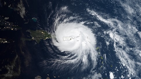
NASA satellite image of Hurricane Maria over Puerto Rico

I can’t imagine what it must be like to have a loved one on an island that’s struck by a major hurricane. The worry must be terrible.

Because I’m an amateur (ham) radio operator, I have received requests from strangers who are desperate for help getting welfare inquiries through to places like Dominica and Puerto Rico after Hurricane Maria struck.

Based on my years of experience in emergency response (including disaster response) and emergency communications. I have some words for such people that I hope will be helpful.

First, it’s important to remember that absence of communication does not mean that your loved one has been harmed. In most cases it means only that the disaster’s survivors temporarily have no way to tell you that they’re OK. So, as hard as it might be, maintain hope.

In the absence of other means of communication, one of the few things a distant family can do is search the Red Cross’ “Safe and Well” website.

Second, in the absence of other means of communication, one of the few things a distant family can do is search the Red Cross’ “Safe and Well” website. For a number of reasons, that’s an imperfect answer, but it’s often the only option. The site does not allow families to send inquiries into affected areas. It does, however, allow them to see if a survivor has added himself or herself to the “safe and well” list. Of course, survivors can do so only if a.) they have access to the internet and b.) they know about the website.

In many cases, ham radio operators like myself are present in disaster-struck areas. It’s logical to believe that a ham outside the disaster area can help people learn if their loved ones are safe. There are some important things, however, that such people might not realize.

Any hams who lived through the disaster (e.g. hurricane landfall) must first deal with the immediate needs of their own households before they can be of help to others. This includes obtaining necessary medical care, shelter, food, etc. Depending on the intensity of the disaster, this could take considerable time.

Likewise, a hurricane can destroy the external antennas a ham needs to communicate with the outside world. Assuming the ham has the necessary materials, he or she can build a temporary antenna, but this can also take time.

Ham radio equipment requires electricity. As I write this, the entire island of Puerto Rico is without commercial power. Except for solar or wind-powered systems, the only electricity available is coming from privately owned generators (typically fueled by gasoline). Any ham who lives on the island and doesn’t have such a power source is off the air (or will be, after batteries die). And hams who have generators can operate their radios only as long as the generators’ fuel lasts. Finding fuel could be a challenge, with roadways blocked by trees and gasoline stations lacking power for pumps.

Now, let’s assume for a moment that there are hams on Puerto Rico whose homes and antennas survived the storm, whose families need no assistance and who have plenty of emergency electricity. It still might not be possible for these hams to receive inquiries from worried families on the U.S. mainland. Why? I’m sorry to say, that they might well have more important things to do with their radios.

In such disasters, ham radio operators are often busy for a time passing emergency and other urgent messages. An ambulance is needed here. A rescue team is needed there. Supplies are needed at that shelter. Such messages can completely occupy local hams for days after a disaster. They have no choice but to reject incoming welfare inquiries until all the emergency and urgent communication is handled.

Next, ham radio channels become busy with outgoing welfare messages. That’s what I was hearing on the radio today. Hams I heard in Puerto Rico were completely tied up sending messages off the island for their neighbors. It was one message after another, without a break for inquiries to flow to the island.

Eventually, the local hams will catch up and be able to accept incoming messages. Just as eventually, telephone and internet service will become available to survivors.

In the interim, difficult as it is, worried families need patience and hope.

What residents need to know about their new outdoor warning siren

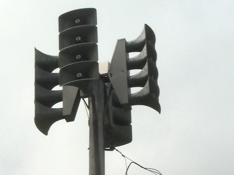
Tornado siren. Outdoor warning sirens are not intended to be heard indoors.

Blogger’s note: Below is an article I submitted to the “The Waynedale News,” a neighborhood newspaper in Fort Wayne, Indiana. If refers to the installation of an outdoor warning siren in a neighborhood that had been without one for years. The newspaper published the article July 7, 2017.

The new outdoor warning siren that’s coming to Waynedale brings with it some true risks that area residents might not have considered. Chief among those risks are over reliance and desensitization. Continue reading →

Remembering a lesson on a derecho anniversary

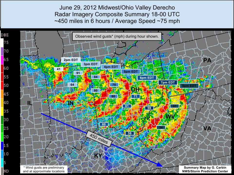
An NWS graphic showing the path of the 2012 derecho

Today is the fifth anniversary of a “derecho” thunderstorm that did widespread damage in northern Indiana and locations to the southeast.

“At the peak of the event,” writes the northern Indiana office of the National Weather Service, “the Fort Wayne International Airport observing equipment observed a peak wind gust of 91 mph.”

“Winds were as strong as an EF-1 tornado over a widespread area,” the NWS web page continues, “which resulted in immense damage along the storm’s entire path.” (Emphasis added by W9LW.)

One of the best lessons of that storm should be that we can have massive damage without a tornado. This was a particularly dangerous severe thunderstorm, but there’s no such thing as a “particularly dangerous situation” thunderstorm warning, so we need to pay attention to all severe thunderstorm warnings, even though such warnings are not uncommon.

See an extensive discussion of the 2012 derecho on the NWS northern Indiana website: https://www.weather.gov/iwx/20120629_derecho

“It’s all about the updraft”

College of DuPage meteorology professor Dr. Paul Sirvatka presents at the DuPage County Severe Weather Seminar, March 11, 2017

The title of this post is one of the main points of a presentation I heard at the DuPage County (Ill.) Severe Weather Seminar March 11. College of DuPage meteorology professor Paul Sirvatka reminded spotters that the key to spotting a tornado in a classic supercell is knowing where the updraft is. As Dr. Sirvatka put it, a tornado is a “big sucky thing” that forms under an updraft.

Unfortunately, updrafts are not always easy to find. Depending on your location, important storm features can be obscured, making spotting difficult. And the closer you get to a storm, the more difficult it becomes to identify the important features.

Continue reading →

Top 5 ways to get severe weather warnings

(Updated March 31, 2025)

It’s hard to protect yourself and your family from tornados, damaging straight-line severe thunderstorm winds, or large hail, if you don’t know that the National Weather Service has issued a tornado or severe thunderstorm warning for your location.

So, here’s my list of the best ways to get tornado, severe thunderstorm and flash flood warnings.

Continue reading →

A chat with the creator of the weather podcast genre

For 11 years, Alabama broadcast meteorologist James Spann (ABC 33/40, Birmingham) and several of his friends in the weather enterprise have produced a weekly podcast (internet talk show) called WeatherBrains. It was the first in what has become a group of weather-related podcasts that are jointly celebrating the first-annual National Weather Podcast Month in March.

The weather brains normally record WeatherBrains on Monday evenings. Audience members can watch the discussion live on YouTube, watch it later on YouTube or download the program as an audio recording for listening at their convenience.

W9LW’s Ramblings had chance to talk to Spann about the show that started the weather podcast genre and now has an audience in the tens of thousands. Watch the 14-minute interview on YouTube or read it below. The transcript includes a few helpful notes and hyperlinks.

W9LW’s Ramblings: What prompted you to get into the podcast business? Continue reading →

Believe it or not, some snowstorm forecasts on Facebook are bogus!

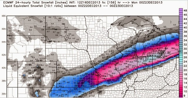
Snowfall forecast map from the European numerical weather prediction model run on Dec. 16, 2013 for the forecast period Dec. 22-23. What actually happened Dec. 22 and 23 wasn't even close to this!
Widely shared snowfall forecast map from the European numerical weather prediction model run on Dec. 16, 2013 for the forecast period Dec. 22-23. What actually happened Dec. 22 and 23 wasn’t even close to this!

Winter weather is just around the corner in Indiana, which means so are authentic-looking but bogus long-range snowstorm forecasts on social media.

It won’t be long before we see claims that a storm a week or more away will bring huge snow accumulations. Many will have official-looking forecast maps, like the one above (which turned out to be wrong, by the way).

But these posts won’t be the work of professional meteorologists. Many will be the creations of school kids, passing themselves off as weather experts.

This is Winter Weather Preparedness Week in Indiana, so it seems like a good time to prepare readers for the ominous-looking but unreliable snow forecasts they’ll soon see.

To understand what amateur weather enthusiasts put on social media, it helps to know something about the computer programs that professional meteorologists use to guide their forecasts. These programs are called numerical weather prediction models. They simulate Earth’s atmosphere by describing it in a complex series of very complicated mathematical formulas.

The programs built on these formulas run several times a day on supercomputers around the world. Much of the output of these programs is available on the Web, in both numeric and graphical form.

The output of computerized atmosphere models is inherently inaccurate for several reasons, including:

  1. It’s not yet possible to completely describe our chaotic atmosphere in mathematical equations and
  2. The programs don’t have access to enough data about what our atmosphere is doing at the time they run (e.g. what the temperature, wind speed and wind direction are 10,000 feet over any given part of the planet).

Nonetheless, these programs kick out predictions of what the weather might be at any location at any time, as far in the future as 16 days, despite that fact that no computer or human can reliably forecast the weather that far in advance.

Now, imagine a young weather enthusiast who craves attention and loves snowstorms (because they get him out of school). When he sees an indication of heavy accumulations in the output of a single computer model, he might paste that model’s map into a Facebook post in which he writes a dire forecast of impending doom. Such an amateur forecaster might not be aware of (or care about) the model limitations described above. But she’ll love all the “likes” and shares her post receives!

So how do I know what to believe? First, I’m automatically suspicious of any social media post that forecasts specific snowfall amounts more than a couple days in advance. Second, I ignore any forecast that doesn’t come directly from professional sources I trust, such as:

  • The National Weather Service.
  • Local, degreed broadcast meteorologists.
  • Certain commercial weather forecasting companies.

If that ominous snowstorm forecast didn’t come from one of the above, I won’t share it on social media. I hope you’ll join me in that practice.

How new friends changed my attitude about storm chasers

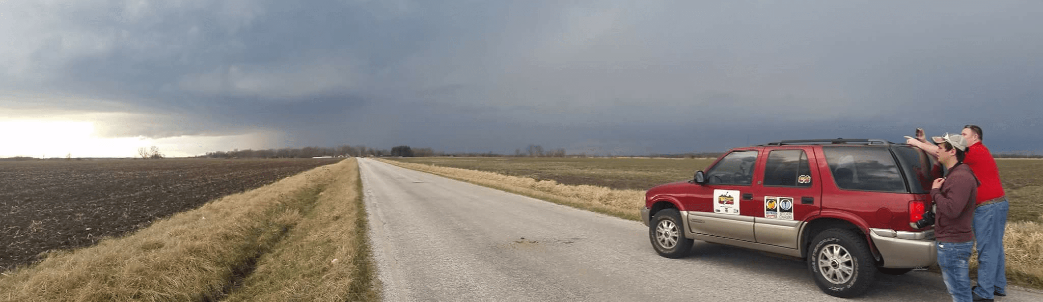
Storm chasers on a storm
Photo by Michael Enfield, used with permission

For some time, I’ve looked at amateur storm chasers with some disdain. I believed that too many were putting themselves into too much danger, just to see, photograph and/or video record tornados. I doubted that many chasers were truly motivated by improving public safety and even fewer were doing real science, no matter what they said. I was concerned that many chasers set poor examples for the general public and that their “antics” encouraged lesser informed people to take uneducated and unwise risks.

I’ve been a SKYWARN storm spotter for more than a quarter century. When talking to friends, family members and even journalists about my volunteer service to the National Weather Service (NWS), I was careful to make sure they understood that I’m not a chaser, like the people they’ve seen on TV or on the Web. My ultimate goal, I’d explain, isn’t to see tornadoes, it’s to help protect my community from possible storms by staying close to home and relaying valuable information to the NWS.

So it was with some trepidation that I attended an event in November, 2015 called INChaserCon, a one-day convention in the Indianapolis area for storm chasers. I’m glad I went. Some of the people I met there changed my thinking. They are admittedly driven by a desire to see tornadoes. But my experience with them demonstrated that they’re also very passionate about getting reports to the NWS.

After the chasers learned that I have access to NWSChat – a private, internet-based text chatroom run by the NWS – they invited me to join them on Zello, a smartphone app with which they communicate with each other—so I could relay their reports to the NWS via NWSChat.

That’s exactly what happened during the August, 2016 tornado outbreak in Indiana and Ohio. As a tornadic storm moved east from Kokomo into the county warning area of my local NWS office, storm chasers John Tinney, Eric Lawson and David Buell reported wall clouds, funnel clouds, etc. via Zello. I relayed those reports via NWSChat.

Then, a storm over my own home in Fort Wayne, Indiana received a tornado warning. Storm chaser Michael Enfield immediately headed toward that storm. Via Zello, he promptly reported a wall cloud, then funnel clouds and then a tornado for me to relay via NWSChat. The NWS survey report recorded the time of the tornado’s initial touchdown as 5:27 p.m. – the same time as Enfield’s report, confirming that he saw and reported the tornado when it first touched down. That storm eventually did EF-3 damage to a rural part of Allen County, Indiana.

Throughout the event, any time the chasers had something to report, if I wasn’t immediately available on Zello, they’d keep trying until I acknowledged their reports. Getting reports through to the NWS was clearly very important to them. By the end of the event, I had typed 50 reports into NWSchat. All but about 15 of those came from storm chasers on Zello. The rest came from storm spotters via ham radio.

By aggressively chasing storms, my new friends put themselves in positions to immediately report weather that was not near any traditional SKYWARN spotters at the time. By religiously reporting, they played significant roles in protecting people in the paths of the storms.

A Facebook post by Lawson sums up pretty well how this particular group of storm chasers sees things:

“I noticed a developing supercell heading towards Kokomo was looking really strong and rushed out the door. By the time I was on interstate 69 southbound the strong EF3 was already in progress and heading towards the town in which I have spent many days of my youth, and is home to many great friends and their families. Hearing reports of the devastation in progress on the radio made my heart sink. I was rushing south in horror wondering if anyone I knew had been hurt. This is the moment that things really changed for me, I felt less excited about seeing tornadoes, and much more concerned with providing accurate information to keep people informed.”

I have no doubt there are other storm chasers out there who rarely report their observations to the NWS. There are likely some that don’t care about anything but the excitement of seeing a tornado.

But I’m convinced that the storm chasers I know are not among these. They’ve changed my attitude about chasers.

Severe weather, ham radio & anything else I feel like writing about